Currumbin’s Hidden Rail Trail

It’s rusted, oyster encrusted and it’s Currumbin’s hidden rail trail.
Our use of highways and high speed trains has seen many old railway lines abandoned. Some old railway corridors have been re-purposed for walking, cycling and horse-riding. Known as rail trails, they transform a dilapidated piece of public infrastructure into a useful public asset. Why? Rail trails attract tourists, encourage active lifestyles, provide safe pathways free of vehicles and fumes, and they often serve as valuable habitat and wildlife corridors.
Old trains travelled slowly through the contours of the land, linking small towns and crossing waterways. And it’s this last purpose that defines Currumbin’s hidden rail trail. Since 1903, it’s been spanning Currumbin Creek.
Of course, being only 173 metres long, the Currumbin Creek railway bridge is unlikely to qualify as a rail ‘trail’ but it is recognised as having historical significance. The bridge was part of the South Coast railway line that ran between Brisbane and Tweed Heads on the New South Wales border. The line operated between 1889 and 1964.
“It is one of only three examples that still exist of infrastructure associated with the original railway line and the only structurally complete bridge still in existence on the line.” – City of Gold Coast
After the railway line closed in 1964, the bridge was used to carry water and sewer pipes as well as pedestrians. As a valuable link between the suburbs of Palm Beach and Currumbin, the bridge was upgraded in 1994 for use as dedicated pedestrian/bicycle pathway.
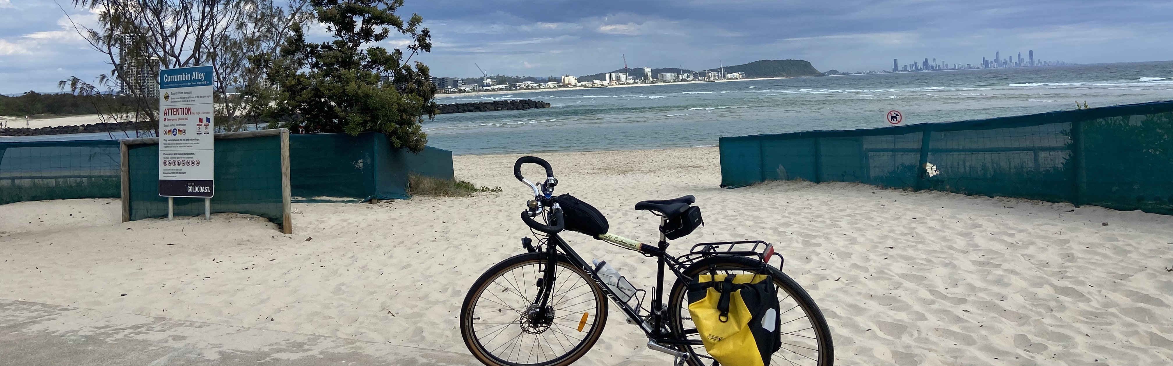
Last Monday, I saw wire security fences appear in the carpark near the bridge. Tuesday, I saw demountable work offices appear. By the end of the week, a sign went up. The Currumbin Creek railway bridge – our hidden rail trail – is to be closed.
Temporarily – April to July – for renewal. Phew!
The sign said: “This 113 year old ex-railway bridge is to be restored to protect its historic significance and improve pedestrian capacity.”
The bridge renewal will see it widened, resurfaced and strengthened.
So with these changes soon to happen, I rode out and took some photos to remember the bridge as it is now.

Public sign with bicycle rider entering the Currumbin Creek railway bridge.
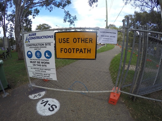
Wire fencing for worksite.
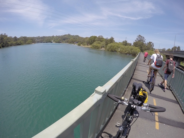
On the bridge at high tide.

Under the old railway bridge at low tide shows rust and oysters.

Beneath the old railway beams and to the right, the bigger faster and often congested motorway.
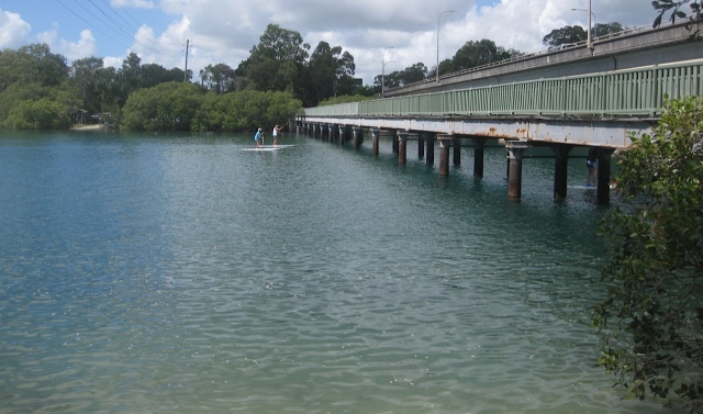
Stand-up paddle boarders preparing to duck their heads as they pass under the bridge.
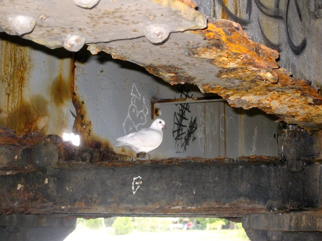
White pigeon reading graffiti on Friday afternoon beneath bridge.

Official graffiti

History sandwich.

Lovely post, written with admiration for the past, present and future. We have many miles of former railways that have been repurposed, they can be brilliant to ride on. Some of them in Edinburgh make you feel you are not even in a city. Thanks
LikeLiked by 1 person
Thanks! The Edinburgh rail trails sound really interesting. In Australia, the current rail trails are typically in rural locations rather than major cities. I’m yet to explore them but as you can imagine, they’re on my list 🙂
LikeLike
I love riding rail trails – the gradients are great for comfortable riding. I agree with fossilcyclist that riding through Edinburgh is great on these trails- so much green.
LikeLiked by 1 person
The gradient and the long straight sections make them perfect for cycling. I read that most railway lines have a gradient of no more than 1 in 40. That means the line would rise 1 metre for every 40 metres. A road might be as steep as 1 in 6. Quite a difference!
Sounds like Edinburgh should be on my list too 🙂
LikeLike
I especially liked the label “history sandwich” on the photo and the pigeon reading graffiti! Also “rusted and oyster-encrusted” – lovely rhyming! I’m glad they are going to restore it to keep it usable, but I’m also glad you’ve taken some old pics to remember what it was like. Thanks for taking us on a trip into the past and showing the trail’s practical use today. 🙂
LikeLiked by 1 person
😀 glad you liked the photo captions Jane. Thanks!
Yes it was a relief to know the historical significance was being valued. I haven’t seen any illustrations of what the restored bridge will look like but by spring I’ll no doubt have some photos to share.
LikeLiked by 1 person
What a great picture of that pigeon, Gail. I always struggle to get decent photos of birds, they don’t seem to like me much!
LikeLiked by 1 person
Well you know Bri, this photo was pure luck. I took two photos – one without the flash and then this one with the flash. I couldn’t believe how photogenic this lovely white pigeon turned out to be – she definitely knows how to ‘strike a pose’ 😀
LikeLike
A lovely post Gail. I was interested to read some of the history about a bridge I have walked many times over the years. I love the photos showing the bridge’s character – the rust, the oyster encrustations and the seagull. Thank goodness, they are restoring rather than destroying it.
LikeLiked by 1 person
Thanks Robyn 🙂 I only learnt of its history earlier this year when the Currumbin RSL posted a photo on Instagram with a caption about the bridge’s former life. So I researched it some more and found it fascinating.
LikeLiked by 1 person
Funny isn’t it? One can live with an object without questioning its history. Thanks for enlightening me.
LikeLiked by 1 person
Thanks for sharing, Gail. Another place to add to my list of places to check out when I move to the Coast next month. I remember the railway line from when I was a child. We holidayed in the Gold Coast during the 60’s. I was only wondering the other day when the railway closed, so thanks for filling me in.
LikeLiked by 1 person
That’s interesting to know Gina… that you remember the railway line from your family holidays. Did you ever travel on it? Also wondering… could there be a murder mystery set on it? 😉
LikeLike
great post – thanks
LikeLiked by 1 person
Thanks Michelle – a smidgen of Gold Coast history 😉
LikeLike
There are still other bits of the old rail line still able to be ridden/walked on (we are walkers). The most southern is the cutting between Coolangatta and Kirra, the bike path from Mitchell Ave through to Durran St Tugun follows the line – in fact when the present Queen’s parents came out for a royal tour in the 1920s, the train they were travelling in stopped here so the company could have breakfast, assumably so they would not spill their tea. Most of the rest of the line except for isolated portions hard to access is now taken over by the M1, however at Nerang it started to deviate east until it met up with the Southport line at Ernest Junction. Quite a bit of the pathway from Kumbari Av Ashmore to Griffith Uni is former rail line plus of course the Ernest Junction tunnel is still there and is being looked after by a band of dedicated volunteers.
LikeLiked by 1 person
It’s interesting to walk or ride these old ways. I enjoy them because they’re more likely to follow the contours of the land as it was. So they seem to have a more harmonious flow about the path they travel. The Coolangatta and Kirra cutting is on my list to explore but I hadn’t heard of the Ernst Junction Susan, thanks! With so little of the rail line remaining, we’re very lucky to have this slice of railway history here at Currumbin.
LikeLike