Wollumbin Circuit – Part 1

Wollumbin’s been around a long time.
Over 23 million years ago, a shield volcano filled the landscape near where I live. Its diameter was over 100 kilometres (62mi) and its height 1156 metres (3,793ft). This large round shape and low profile resembled a warrior’s shield, hence its geological name.
All that remains now is the eroded caldera around a volcanic plug. Yet what remains is significant. A caldera is the large cauldron-like crater that remains after a major eruption collapses the volcano. This volcano left the largest erosion caldera in the Southern Hemisphere. The rim of this magnificent caldera brings dramatic escarpments to the landscape and its valley carries water and soil rich with nutrients.
And as for the volcanic plug, well it’s the first place on the Australian continent to receive the morning sun. English explorer James Cook named it Mt. Warning in 1770 as a reference point for sailors. Yet long before this, Indigenous custodians knew it as Wollumbin. And it was more than a navigational reference point. For tens of thousands of years, Wollumbin has been of spiritual and cultural significance to the Bundjalung people.
UNESCO declared this area Heritage Listed as part of the Gondwana Rainforests of Australia for its “Outstanding Universal Value”.
I’ve driven, hiked and camped in this wonderful caldera but never had I biked it. So with Easter approaching and a Tweed Visitor Guide in our hands, we decided to cycle one of the themed driving trails named: Wollumbin Circuit.
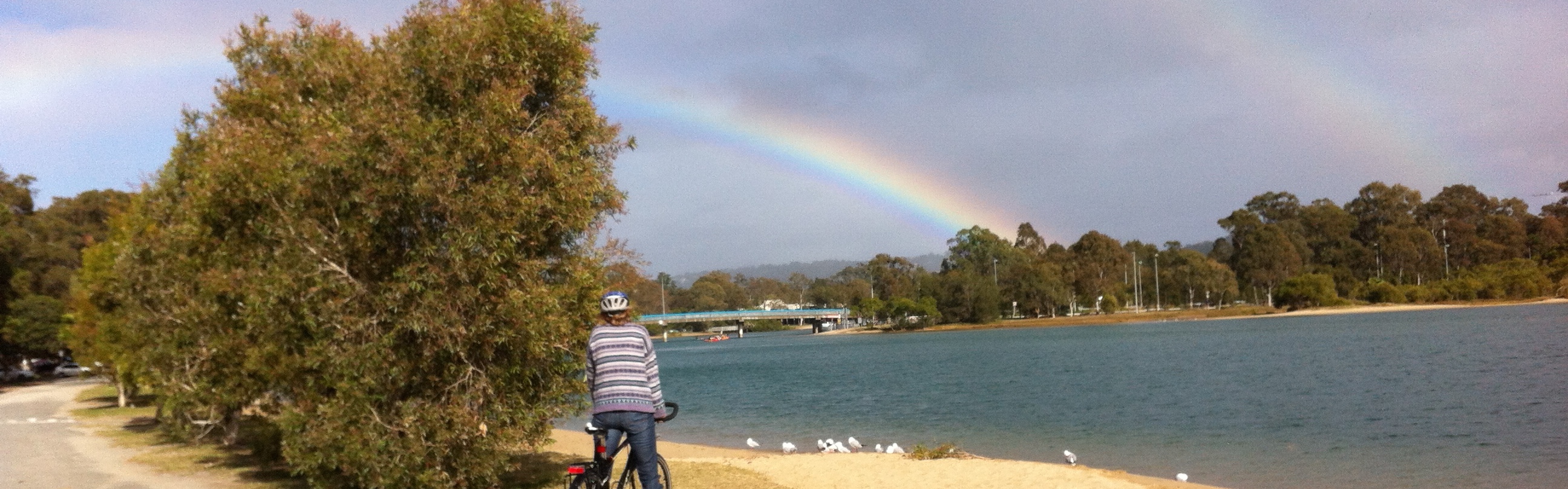
Early Good Friday we drove to the regional town of Murwillumbah, about 40kms south of Currumbin. In the centre of town, Knox Park, was a good location to park the car for the day. After unloading the bikes, stocking them with our picnic food, and eating some breakfast, we pedalled out of town. Right from the beginning, the magnificent Wollumbin was in sight and that’s where it stayed for most of our ride.
At the beginning of the ride, we were able to stay off the road by using the bike paths connecting Murwillumbah High School with the outer suburb of Bray Park. Beyond that, it was all road riding, and with very narrow or non-existent shoulders. At first, I found this a bit daunting and breathed an extra breath after each car passed. Then I settled in and enjoyed the views; and even took some photos while rolling.
Leaving Murwillumbah, our Wollumbin Circuit took us via Eungella to the vibrant village of Tyalgum, then up and down some long rolling hills to Chillingham, along narrow winding roads to Crystal Creek and then returning to Murwillumbah via the whispering sugar cane fields.
Our Wollumbin Circuit saw us ride 52.6kms (33mi) and gain 706 metres (2,316ft) in elevation. Our actual riding time was 3 hours 44 minutes but with views to linger over, wild fruit to pick, and locals to yarn with, it was seven hours before we finished our ride in Murwillumbah.
It was a Good Good Friday. I felt relaxed, invigorated and in awe of this beautiful caldera and its sacred heart, Wollumbin.
To be continued…
Scroll over or tap each photo below to read its caption or enlarge….


Wollumbin Circuit in red. Wollumbin National Park at the bottom of the map in green.

Elevation profile. The two large peaks are the hills between Tyalgum and Chillingham.


Riding towards Wollumbin.

lovely photos Gail. I live in the birthplace of Capt James Cook. North of us are the river Tweed and Chillingham castle . There are white wild cattle on the Chillingham estate. We hope to be cycle camping up in that area at the end of April.
LikeLiked by 1 person
Oh wow Brenda! That’s amazing to know you have a Tweed and Chillingham in your cycle realm too! Our Chillingham doesn’t have a castle but a very popular fruit and vege roadside stall 😀
Shall look forward to reading about your trip up there.
LikeLike
I will never be able to actually take these amazing journeys, I know, but the virtual trips with you are quite marvelous. Thanks, Gail
LikeLiked by 2 people
It’s one of the blessings of the digital revolution. Like you Clare, I really enjoy the experience of learning about other places and lives lived. Thanks!
LikeLiked by 1 person
I’ve jumped from India to
Wisconsin to China to England to France to Australia just in the last half hour!!!
LikeLiked by 1 person
Haha! 😀 Wonderful!
LikeLiked by 1 person
How interesting, Gail, this area is also declared a World Heritage site! You certainly enjoy your adventures, photography and healthy lifestyle. Good on you! 🙂
LikeLiked by 1 person
Thanks Iris! It’s wonderful to immerse in landscape at a leisurely pace. As you know, it allows the place to fill us up and spark our creativity. Thanks for reading 🙂
LikeLiked by 1 person
So true, Gail. Have lovely day! 🙂
LikeLiked by 1 person
I love that it took all day for you to complete the ride. That’s my kind of riding too 🙂
LikeLiked by 1 person
It was great Andrew. Just allowing the day to flow with no real deadline – only to finish before sunset – was wonderful. It gave the day a timeless quality. And although we rode nearly 53kms, I certainly didn’t feel ‘spent’ by the end of the day… quite the opposite actually!
LikeLiked by 1 person
great stuff
Hugh
________________________________
LikeLiked by 1 person
Thanks Hugh! It was a superb ride and just on our doorstep too 🙂
LikeLike
That was a long ride Gail. I can’t imagine a more scenic one though. I love the area, so diverse and full of things to see. What a great Easter excursion!
LikeLiked by 1 person
It was a great way to spend the day Robyn. The scenery was spectacular and, as you can imagine, our snack-filled panniers made for a moveable feast… apt for an Easter 😉
LikeLike
What a relaxing day with beautiful views! Great pics and write up, Gail. 🙂 By the way, I’ve been wanting to climb/hike Mt Warning for ages but not sure if my fitness and/or knees would get me up there. I would love to be there for the Eastern coast’s earliest sunrise. 🙂
LikeLiked by 1 person
Thanks Jane! We enjoyed the ride immensely. It’s a popular hike and also attracts its fair share of trail runners too. The trail is only steep at the very end where there is a chain with some rocks to scamper up (but not exposed).
LikeLiked by 1 person
Is your end of Australia always sunny? 🙂
LikeLiked by 1 person
Only when it’s not raining Jean 😀
Here’s a rainy day story…
LikeLike