South Burnett Rail Trail

The jacaranda trees were in full flower, colouring the landscape with splashes of lilac and matching the radiance of a blue sky made clear from recent rains. Grevilleas stood thick with burnt orange blooms. Rows of crops flourished green in the rich red volcanic soil. Springtime on the South Burnett Rail Trail was picture perfect.
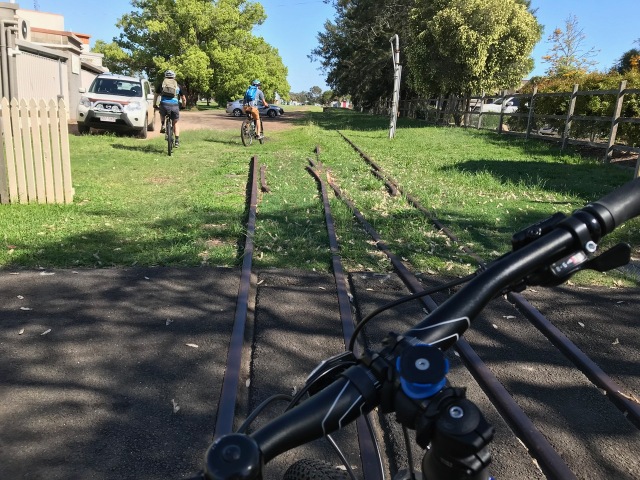
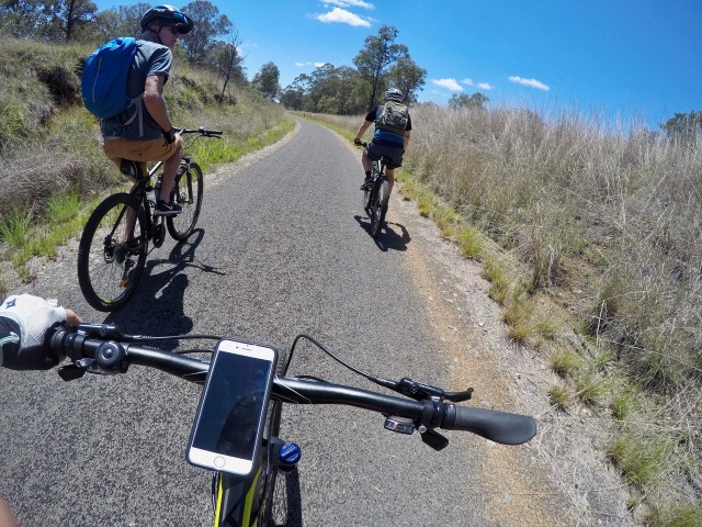
Situated in Queensland’s southeast, the South Burnett Rail Trail (SBRT) stretches for 44 kilometres between the small rural towns of Kingaroy and Murgon. The entire trail is asphalt and makes for easy riding. Because the SBRT is built on the path of a former railway line, the gradient is gentle and there are small settlements dotted along the trail every six or seven kilometres. This means you can make the trail your own. You can design a ride that’s 6, 12, 30 kilometres or, if you want a longer distance, you can do a return ride of the full trail and clock up 88 kilometres.
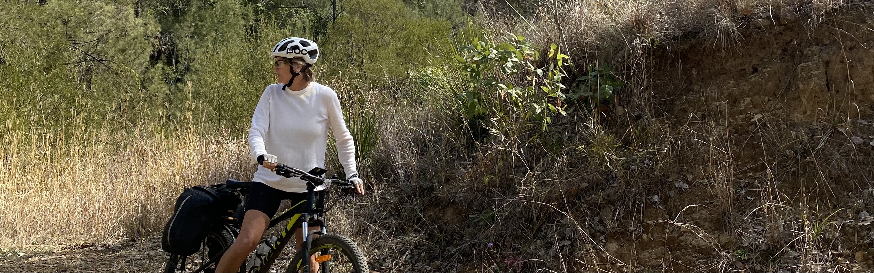
I rode the SBRT with my two cycling brothers and we chose a one-way ride of the entire 44 kilometres. We rode at a leisurely pace – stopping to take photos, read the information signs at each former railway station, and to enjoy a coffee and cake at the Wooroolin café. Our riding time was just under three hours and our stops added another 40 minutes.
The three of us rode mountain bikes but the smooth asphalt and gentle climbs of the SBRT would suit most bike types – road, hybrid, electric, mountain, touring and folding. And with the opportunity to ride shorter distances, even little wheels pedaled by little legs could enjoy the SBRT with their parents or grandparents.
The SBRT is well-signed with information for interest, direction and safety. Every kilometre there is a location marker giving distances and GPS coordinates. At every road crossing (these are side roads, not major roads), there are chicanes to warn and slow cyclists when approaching the intersection.
The South Burnett Rail Trail traces a past rich with stories. A hotel once owned by a former circus magician. Art Deco architecture and grand hotels that signal the prosperity surrounding these small railway stations in the early 1900s. And the long-time past of the First Australians who knew this country intimately.
Even though the SBRT has gentle gradients, the land’s elevation is worth considering when planning your trip. With Kingaroy sitting at 442 metres above sea level and Murgon at 316 metres above sea level, we started our ride in Kingaroy and enjoyed a largely downhill run. Along the way we met thirteen bridge crossings, five majestic brumbies, four swooping magpies, two grazing cows and one goanna who scurried up the nearest gum tree.
Ours was a good day of riding, chatting, sharing stories new and old, and making plans to visit again.
Start of SBRT at Kingaroy at O’Neill Square
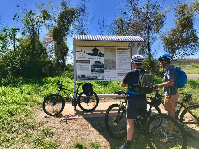
Information shelters at former railway stations
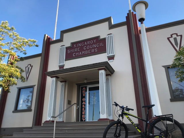
Art deco architecture, Kingaroy

The Cecil Hotel, Wondai
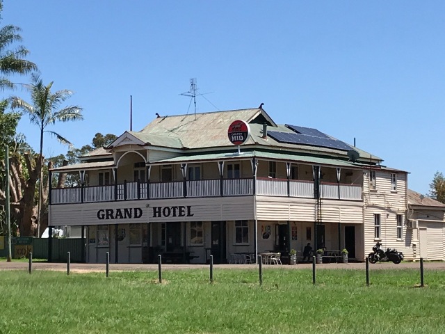
Historic hotel in Wooroolin
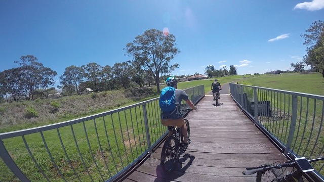
Bridge crossing
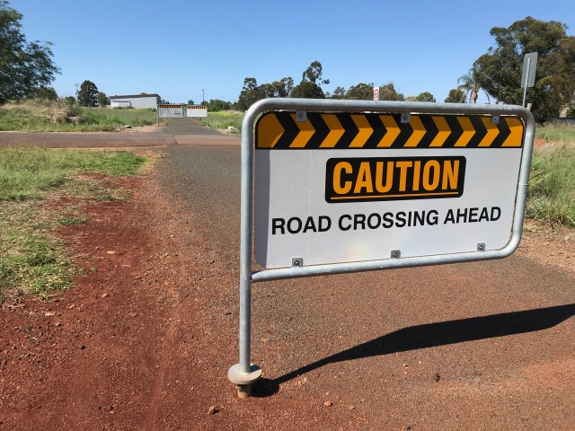
Chicane as we approach road crossing
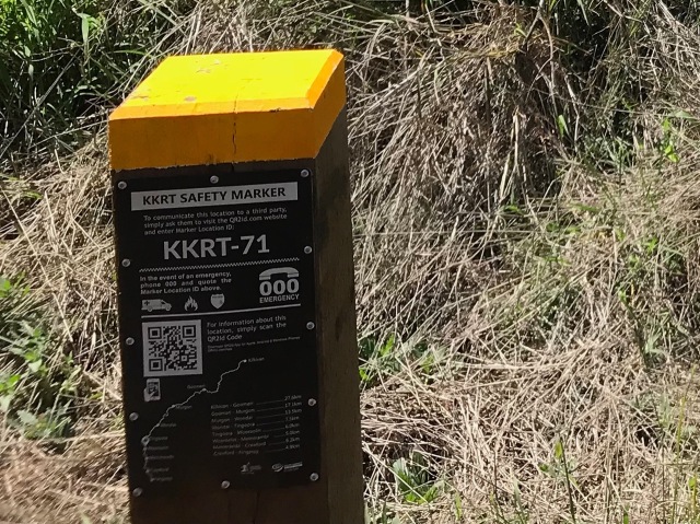
Safety Markers* with GPS coordinates
* The safety markers are labelled KKRT because they mark the distances for the Kilkivan to Kingaroy Rail Trail of which the South Burnett Rail is part of.

Former bridge pylon on the way to Murgon
A good day riding.

Looks idyllically! Is there any evidence of the first Australians?
LikeLiked by 1 person
The settlement of Wooroolin derives its name from an indigenous word that means ‘place of water’. Here there is a palustrine wetland that is a haven for 25 species of migratory birds. Nowadays there is a bird hides for viewing and photographing the wetlands which is easily accessed from the trail.
LikeLiked by 1 person
Sounds like a gre ad t time of year to ride this lovely rail trail 😎
LikeLiked by 1 person
On the day, the conditions were good Helen. We’d planned to ride the trail the previous weekend but a fierce tornado brought heavy rain and hail to the area. So we postponed. The SBRT seemed to be spared from any destruction and we noticed the trees, grasses and crops were flourishing from the much-needed rain.
LikeLike
Great description Gail
Have done this ride several times and agree it is perfect way for young riders to experience cycling
My only suggestion would be a rest stop (water) somewhere on the Wondai/Murgon section as this is the only section which is not close to the road or any towns
Love this trail
LikeLiked by 1 person
Thanks Andrew – I’m glad you enjoyed the story. The day we rode was extremely hot and I found that section between Wondai and Murgon a long stretch and kept a close eye on my drinking water. I think your suggestion of a rest stop with some shelter and drinking water is a good one for the council to consider.
We did return the following year and brought our partners and extended family. Had a great time!
LikeLike