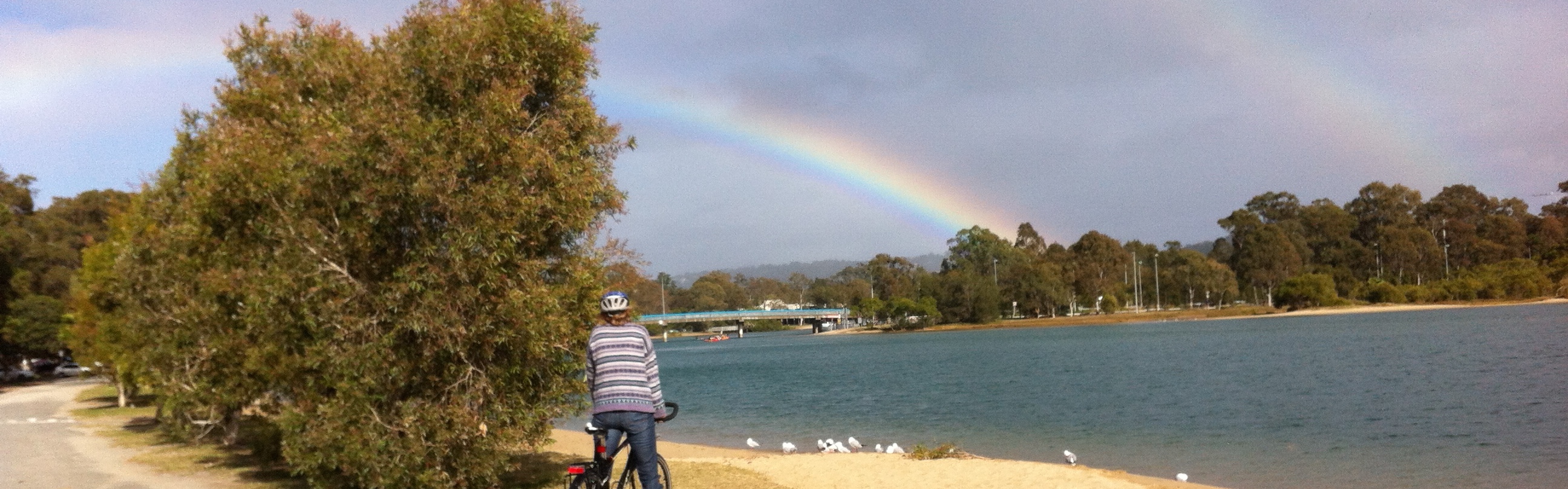

At latitude 28.0° S, longitude 153.4° E, Easter marks the last hurrah for summer. It seems not to matter whether Easter falls early or late, many see it as the last beach holiday, a close to swimming, sandy feet and salty hair.
Yet with the water temperature dipping to 19°C in the depths of winter while the minimum atmospheric temperature averages 12°C, Easter doesn’t mark the end of beach time, swim time or surf time for me and other beachlovers.
This week, autumn arrived. The southwesterly turned up making the air cooler than the ocean and fanning the foamy fringes of her waves.
This change of season typically brings clear skies, cooler temperatures and softer sunshine. And that makes it great weather for swimming and riding.
So I’ve gathered my Easter essentials and hope you have too. I wish you an especially peaceful time enjoying what Easter brings to you.
Happy Easter!

It’s rusted, oyster encrusted and it’s Currumbin’s hidden rail trail.
Our use of highways and high speed trains has seen many old railway lines abandoned. Some old railway corridors have been re-purposed for walking, cycling and horse-riding. Known as rail trails, they transform a dilapidated piece of public infrastructure into a useful public asset. Why? Rail trails attract tourists, encourage active lifestyles, provide safe pathways free of vehicles and fumes, and they often serve as valuable habitat and wildlife corridors.
Old trains travelled slowly through the contours of the land, linking small towns and crossing waterways. And it’s this last purpose that defines Currumbin’s hidden rail trail. Since 1903, it’s been spanning Currumbin Creek.
Of course, being only 173 metres long, the Currumbin Creek railway bridge is unlikely to qualify as a rail ‘trail’ but it is recognised as having historical significance. The bridge was part of the South Coast railway line that ran between Brisbane and Tweed Heads on the New South Wales border. The line operated between 1889 and 1964.
“It is one of only three examples that still exist of infrastructure associated with the original railway line and the only structurally complete bridge still in existence on the line.” – City of Gold Coast
After the railway line closed in 1964, the bridge was used to carry water and sewer pipes as well as pedestrians. As a valuable link between the suburbs of Palm Beach and Currumbin, the bridge was upgraded in 1994 for use as dedicated pedestrian/bicycle pathway.
Last Monday, I saw wire security fences appear in the carpark near the bridge. Tuesday, I saw demountable work offices appear. By the end of the week, a sign went up. The Currumbin Creek railway bridge – our hidden rail trail – is to be closed.
Temporarily – April to July – for renewal. Phew!
The sign said: “This 113 year old ex-railway bridge is to be restored to protect its historic significance and improve pedestrian capacity.”
The bridge renewal will see it widened, resurfaced and strengthened.
So with these changes soon to happen, I rode out and took some photos to remember the bridge as it is now.

Public sign with bicycle rider entering the Currumbin Creek railway bridge.
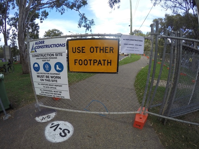
Wire fencing for worksite.
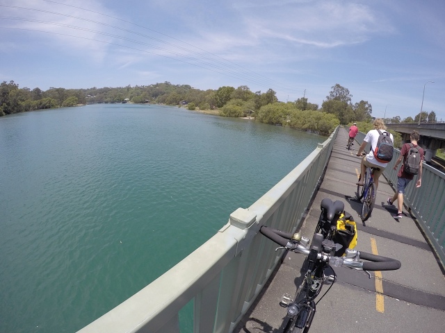
On the bridge at high tide.

Under the old railway bridge at low tide shows rust and oysters.

Beneath the old railway beams and to the right, the bigger faster and often congested motorway.
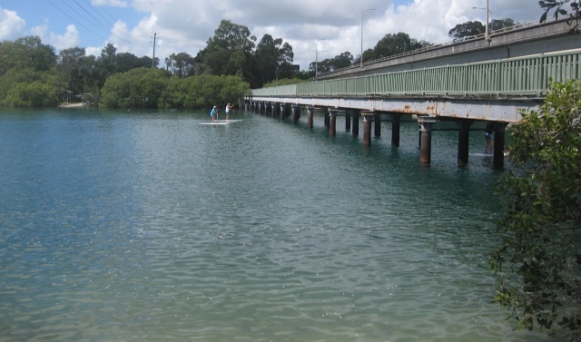
Stand-up paddle boarders preparing to duck their heads as they pass under the bridge.
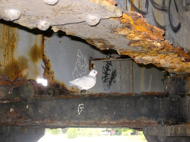
White pigeon reading graffiti on Friday afternoon beneath bridge.

Official graffiti

History sandwich.

This is the third story is a series about my first overnight bicycle tour. This tour, which revealed the delights of Billinudgel’s bushy belly and the dilemma of tour planning, is now affectionately remembered as Le Tour de Food!
We might have travelled slowly, but there was no risk of us running out of food.
We carried vegemite and cheese sandwiches made on sourdough bread, bananas, a tube of vegemite, chocolate coated sweets called Wallaby bites, cut carrots, blueberries and a block of dark chocolate. We each carried a thermos of green tea, which was excellent for staying hydrated and I transported a neatly packaged, brick-shaped (and almost brick weight) Pecan and Date Loaf lovingly baked by Jane.
Added to that were clothes, shoes, toiletries and a first aid kit. With both panniers full to the brim, I wondered how we’d manage if we had to carry camping equipment as well!
But of course, this was the first tour. And we designed it to be an easy ‘first try’ at bicycle touring. For this first trip, we were ‘plastic card’ tourers, staying two nights in a comfortable apartment by the Brunswick River. If it rained, it didn’t matter. We had a clean, dry place as our destination.
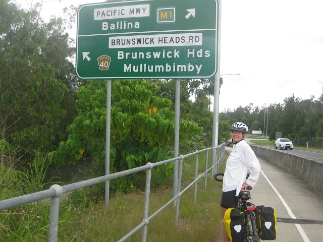
At 63kms (39 miles), this was the longest ride I’d attempted. About nine years earlier I rode with a Sunday morning cycling group and clocked the occasional 60km ride. But that was on a flat bar road bike and I was nine years younger. In March 2015, I rode 45kms with my brother through the canefields on my touring bike but completely free of any luggage. Even during my year of cycling through the seasons in 2014-2015, most of my longer journeys had been around 20 to 30kms and usually not with a full load.
Mentally I’d divided the trip into three main sections each of roughly 20kms:
- Currumbin to Kingscliff,
- Kingscliff to Pottsville, and finally
- Pottsville to Brunswick Heads.
This helped me stay focused on where I was, and allowed me to acknowledge what I’d completed and what I still had to ride. It’s like that well-worn management quip of: ‘how do you eat an elephant? One bite at a time.’ It’s might be overused but it works.
So while my mind was taking the trip in bite size pieces, my stomach was too. Snack by snack we rode our way through each leg of the journey.
I know we carried far too much food. It wasn’t like we were going into the wilderness or away from access to shops for long lengths of time, but somehow the carrying of food, despite its weight, gave me some comfort. It meant that if I needed refuelling, at any time, I could simply pull over and eat! And that would keep my wheels turning.
Viva la Tour de Food!

Panniers filled to the brim!

View north from Cabarita Headland between Kingscliff and Pottsville.
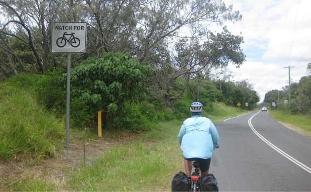
The Wooyung stretch – flat, hot and fast, but considerate, cars.
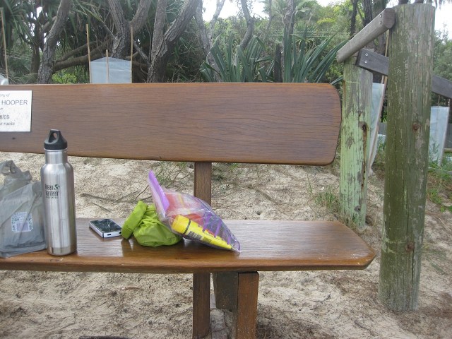
New Brighton snack spot with a beach view – see next photo.
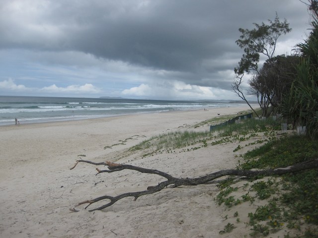
New Brighton beach – with rain looming.
Arriving at Brunswick Heads – just before the rain fell.
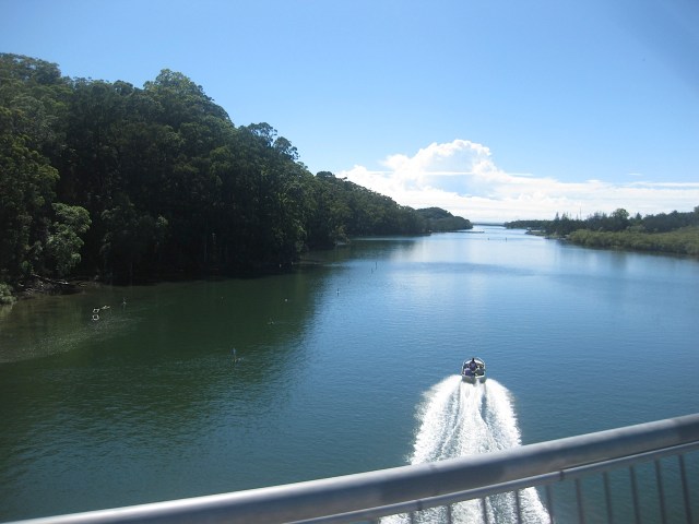
Brunswick River on our return trip under sunny skies.
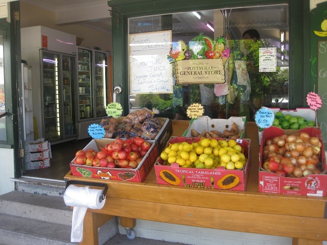
Snack spot #424 – The Pottsville General Store.

Gorgeous Cudgen Creek at Kingscliff for a SwimSnack Combo 🙂

Viva la Tour de Food!
